- +91 828 491 2313
- info@terrageosurveys.com
- India

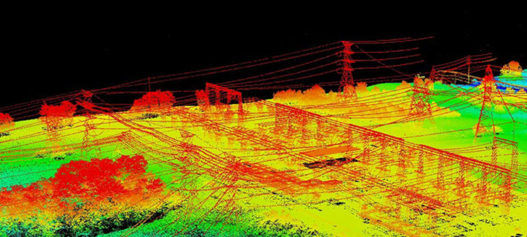
Light Detection and Ranging (LiDAR) is method of mapping that allows high levels of detail to be recorded about topography, vegetation, buildings, infrastructure, and more.
Using fixed wing and multi-rotor technology equipped with a multitude of sensors, we carry out aerial LiDAR surveys for the mapping of land, property and infrastructure. We only employ the services of UAV pilots who are professionally trained, experienced surveyors and DGCA licensed to operate in India. We also operate overseas. Low level LiDAR surveys using specialist heavy lift UAV’s equipped with high accuracy LiDAR sensors enables us to penetrate vegetation and produce Digital Terrain Models which is very often unachievable with photogrammetry methods.
Applications for UAV aerial LiDAR surveys include:

Light Detection and Ranging (LiDAR) is method of mapping that allows high levels of detail to be recorded about topography, vegetation, buildings, infrastructure, and help with detail analysis.

Aerial surveying is a fast and efficient method of data collection which has a range of applications in topographic and route surveys, urban planning and mapping, construction, agriculture, mining and visual inspection surveys.

With Land surveys we can provide a suite of measured land, building and engineering surveying services to our clients for any type of project. Utilizing the latest technology including total stations, GNSS and Handheld GPS.
©2025. Terrageo Surveys. All Rights Reserved.